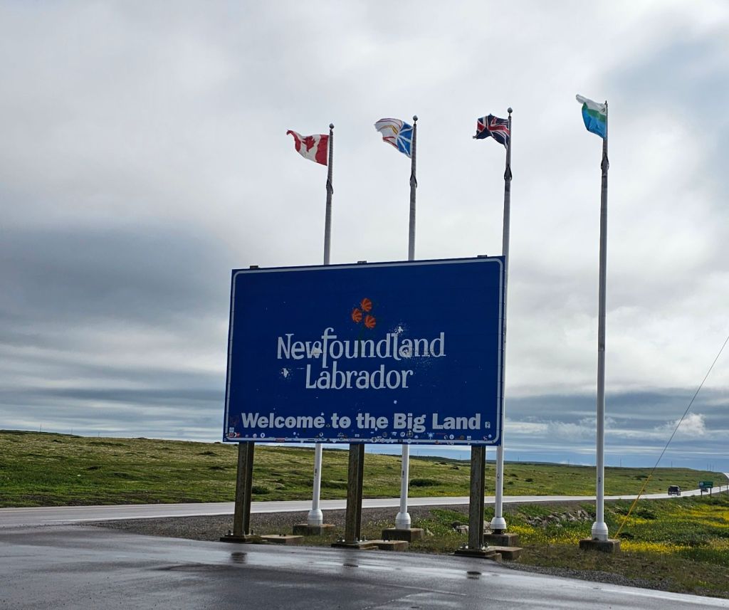
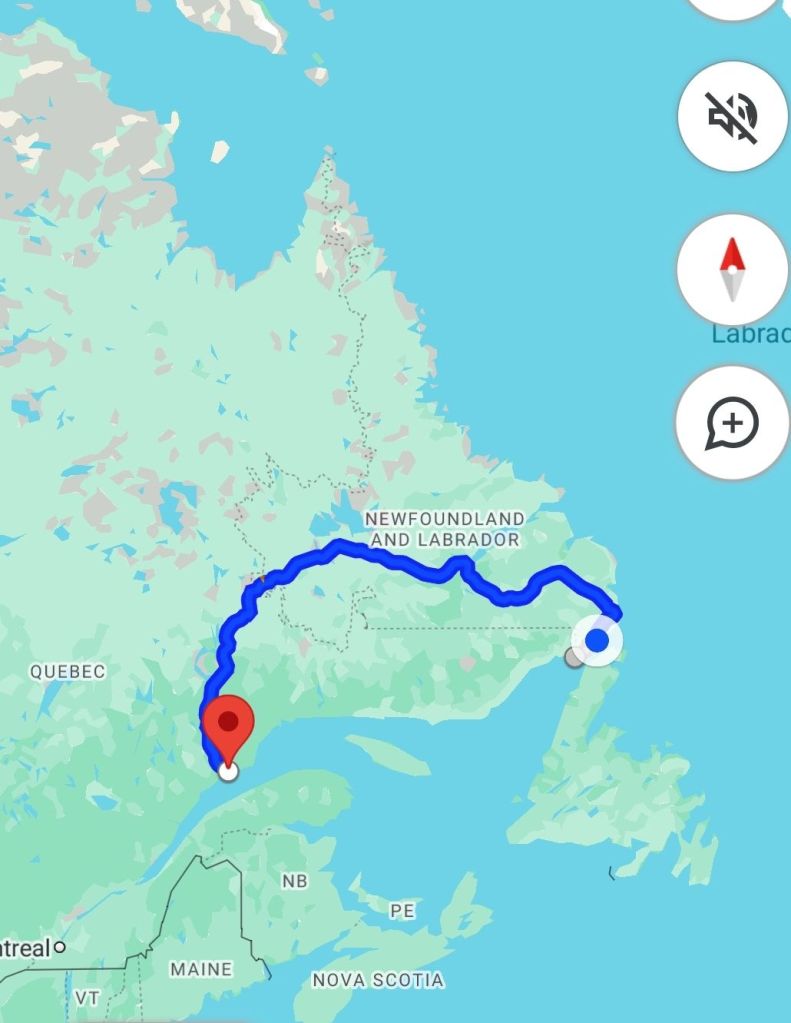
Cloudy this morning and cool but we are on a ferry anyway. Up and out by 6:30 to sit in line for the ferry. Watching how a ferry is loaded is fascinating. This ferry to Labrador does have some tourists in cars and RVs and even a bus from Halifax but is mainly workers in pickups and a few transports. Once you get to the other side, there is only one road, the Trans Labrador Hwy and it’s 1700 km from Blanc Sablon to Baie Comeau on the north shore of the St. Lawrence River.

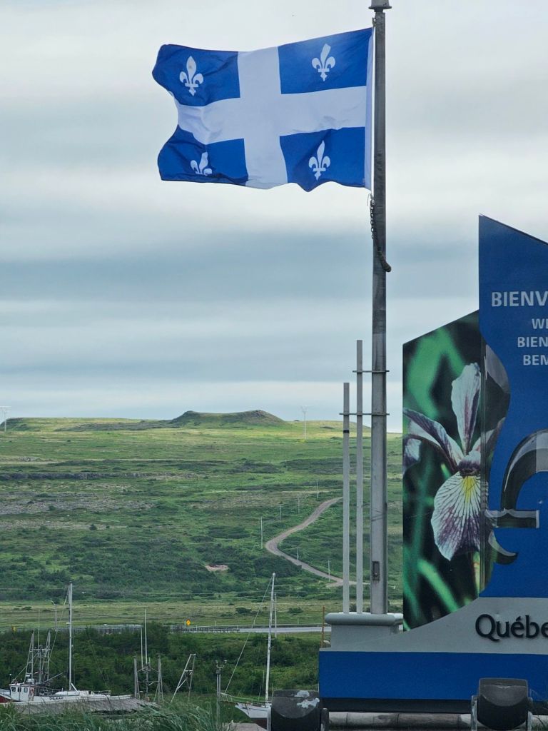
The ferry runs between St. Barbe in Newfoundland to Blanc Sablon ( white sands) in Quebec. Blanc Sablon is the most eastern community in Quebec and is not connected directly by road to the rest of the province. Not sure if there is a ferry along the St. Lawrence westward to Sept Isles.
The times zones are crazy. Blanc Sablon, in keeping with the rest of Quebec is in the eastern time zone, parts of Labrador are in the Atlantic time zone, and parts are on Newfoundland time. We’ll be in eastern time when we land but back into Atlantic later in the day. We’ll let our devices figure out what time it really is.
Brian made coffee while we were waiting for the ferry. Breakfast onboard was scrambled eggs, bologna and toast. The sailing is an hour and three quarters, always in the sight of land, across the Strait of Belle Isle ( taking me back to my childhood geography).
I wonder where this tour bus load is going? We encountered the Airstreams again at the Ferry dock in Blanc Sablon. It would be about the right time in their itinerary for them to come back from Labrador.
Just as I got out of the van to take this picture, the tour bus pulled up. I became the official photographer for a group photo. 41 people from all over Canada and the US.
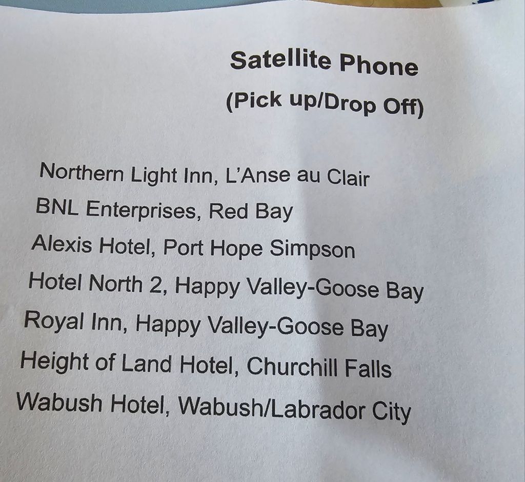
We have hundreds of miles without cell service after today. We were told we could pick up a satellite phone, except that there aren’t any.
The name “Labrador” is thought to come from the Portuguese word lavrador, which means “small landowner” or “farmer”. Portuguese explorers used the term to describe the coastlines of the region as early as the 16th century. One theory is that the name originated with João Fernandes, a Portuguese explorer who was a llavrador and explored the coast of Greenland. References to “the labrador’s land” eventually became the name of the area.
Blanc Sablon was known to early European explorers who may have named it after the fine white sand of the eponymous bay (blanc means “white”, whereas sablon is the diminutive form of sable meaning “sand”). Or it may be named after Blancs-Sablons Cove in Saint-Malo, home town of Jacques Cartier, who landed at the place in 1534 and set up a cross nearby.
During the 16th and 17th centuries, Basque and Portuguese fishermen seasonally frequented the area. Permanent settlement did not begin until the 19th century with the arrival of French Canadians, Acadians, and Jersey settlers. Fifty hectares of land in Blanc-Sablon were designated a National Historic Site of Canada in 2007, as they contain over 60 archaeological sites relating to 9000 years of human occupation, including the Archaic, Dorset and European periods
Blanc Sablon National Archeological Site
The archaeological sites within Blanc-Sablon are demonstrative of the continuous occupation of the Quebec-Labrador peninsula by Indigenous Peoples for over 9000 years. The site is located on the banks of the Blanc Sablon River, which lies between the Atlantic Ocean and the Gulf of the St. Lawrence. The sheltered harbour into which the river flows benefits from the cold Labrador Current, which stirs up nutrients, contributes to the richness of the region’s waters and attracts a variety of marine life. The quantity and diversity of wildlife remains found at the site testify to the importance of coastal resources, particularly seals, for the diet of the area’s inhabitants and explains why this area was occupied repeatedly for millennia by many aboriginal peoples, including Archaic, Post-Archaic, and Dorset.
First stop on our route was the lighthouse at L’Amour. This remote lighthouse museum provided more information about the first Europeans to settle this coast.


The Basques hold a significant historical presence in Red Bay, Labrador. This region served as a prominent whaling center during the 16th century, attracting Basque fisherman and whalers who played a vital role in the local economy.
The Basques, hailing from the Basque Country region between Spain and France, were renowned for their expertise in whaling and fishing. They established a thriving industry in Red Bay, contributing to the growth and prosperity of the town. The Basque whalers arrived in Red Bay to hunt whales for their valuable oil, which was used in a variety of products during that time.
Evidence of the Basque presence in Red Bay can still be seen today, with archaeological sites and remains providing insight into their activities and way of life. In fact, Red Bay is home to the Red Bay Basque Whaling Station, a UNESCO World Heritage Site that preserves the rich history of the Basque whalers in the area.
It is the earliest, most comprehensive and best preserved archaeological testimony of a pre-industrial whaling station. It was used for coastal whale hunting in the summer, the butchery of the whales, and the rendering of the oil and its storage. The whale oil was sold in Europe primarily for lighting purposes. The property includes the remains of rendering ovens, cooperages, a wharf, living quarters, and a cemetery, together with the underwater wrecks of vessels and whale bone deposits.
We visited the whaling station after a wonderful lunch of cod fish and chips at the Whalers Restaurant where we encountered the tour bus again. Now I know what they did today.
The UNESCO site featured artifacts from a whaling boat that had sunk in the bay and revealed a lot about the industry. Rather than recreating the boat, after studying it in depth, they put it back where they found it.
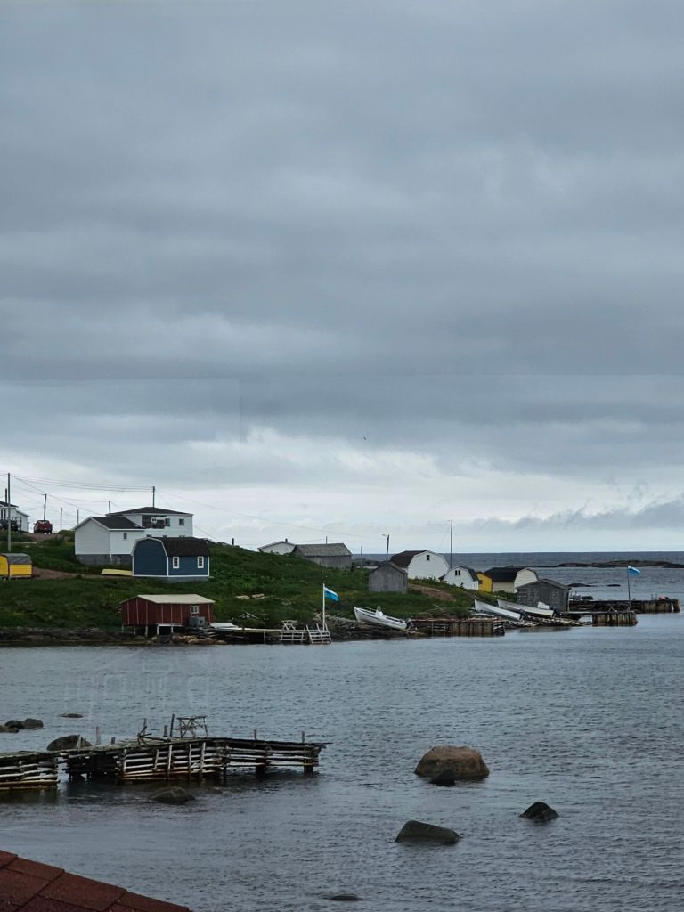
Our campsite today is the most unusual yet. There aren’t many places to camp along yhos route and we were told at the visitors center earlier today that we could camp anywhere as long as the area wasn’t posted otherwise. When we pulled into Red Bay, we were also looking for a satellite phone at BNL enterprises. It turned out to be a convenience store with a gas pump. The owner didn’t have any phones but she did have 4 campsites in her parking lot with water and electric. Sold! She also had washrooms, shower and laundry. There are 2 other units here. While we are right on the highway, we have a full view of beautiful Red Bay out the rear. Unfortunately, we now have black flies to deal with. Nasty things. I have no place to put up the tent, so inside it is. Our next door neighbors are wearing bug nets. Smart!
This is spectacular scenic country. Just when you think it can’t get more beautiful, it does.
Sun is shining but it’s cool and the black flies make it impossible to be outside. The view out the back door is magnificent.
Tomorrow we leave the coast and head inland. We will also lose the casual tourists who usually only go as far as Red Bay. The only internet we will have will be our own. It’s why we have it.
Just catching up on the news, although I’d really rather not. Dinner is grilled cheese sandwiches on cinnamon bread, grapes and ice-cream.


You must be logged in to post a comment.