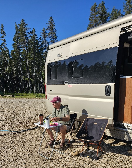
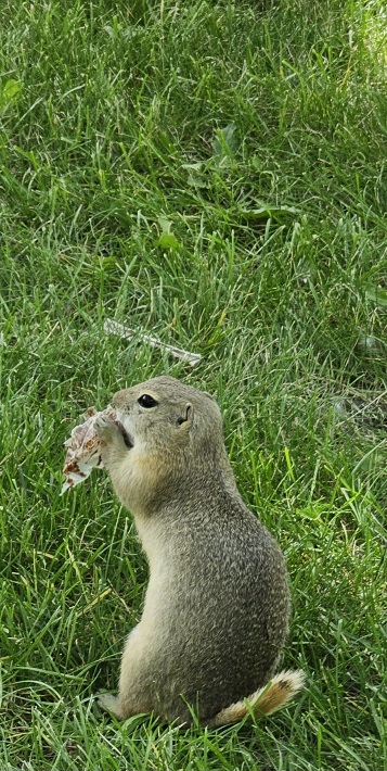
Gorgeous morning and finally warm enough to eat outside. We have a 4 hour drive to Moosjaw, SK via Swiftcurrent, SK. It was my turn to start off driving. Scenery much the same as yesterday, rolling farmland. The trickiest part of the drive was trying to avoid hitting the prairie dogs who always seem to want to see what’s on the other side of the highway. Lots of meat provided for the magpies and the ravens who likewise occupied the road. Not enough meat on a prairie dog to interest the vultures.
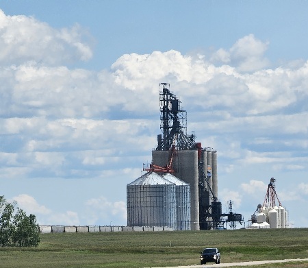
Oil rigs in the fields appeared around the Swift Current area. Other early industries included gathering bison bones for use in fertilizer manufacturing, the making of bone china and sugar refining. Oil was discovered at Fosterton in 1952, thirty miles northwest of the city. This first well continued to pump oil for over 40 years. Since then, with almost 4,000 wells completed in the area, the Shaunavon Formation has yielded 500 million barrels in total production. During World War II, the United Kingdom was considered an unsuitable site for training pilots. The British Commonwealth Air Training Plan identified the Canadian Prairies, with their clear weather and great distance from enemy territory, as an ideal alternative. In 1941, the Number 39 Service Training Flying School was constructed east of Swift Current, hosting over one thousand servicemen at all times until its closure in March 1944.

The Tunnels of Moosjaw
The tunnels present three tour attractions: Bunker 54, Passage to Fortune and The Chicago Connection.
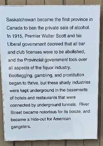
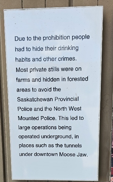
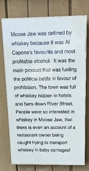
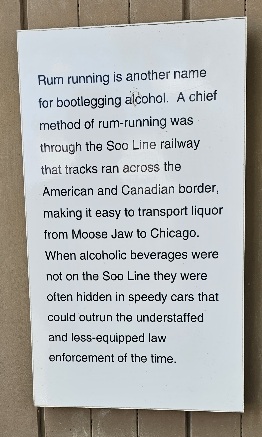
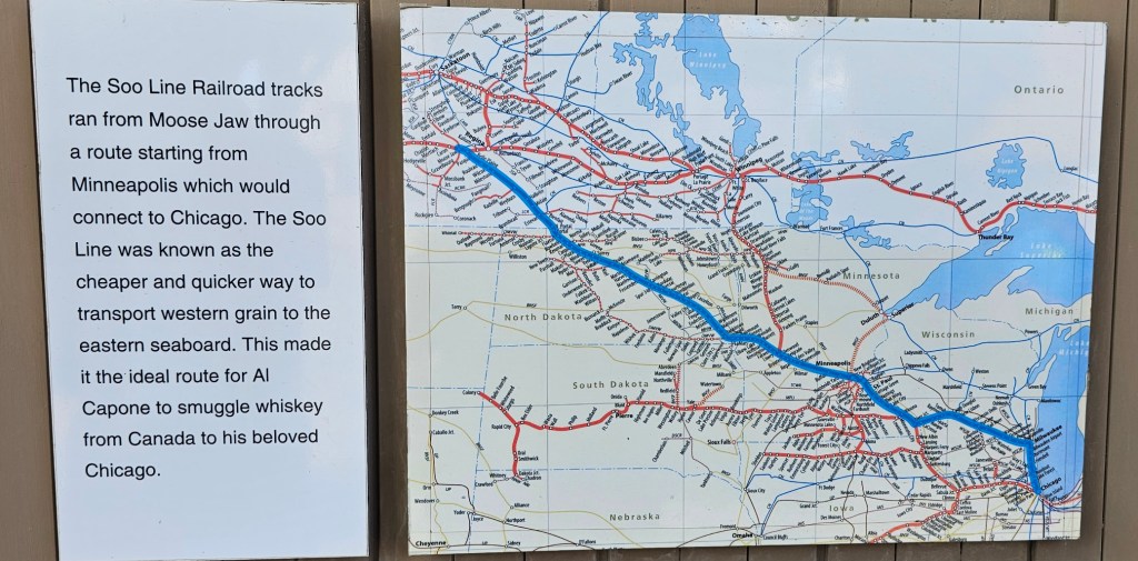
The tunnels became a hub of renewed activity in the 1920s for rum-running during Prohibition in the United States. They were reported to have warehoused illegal alcohol that was shipped to the U.S. via the Soo Line Railroad. The tunnels were also used for gambling and prostitution, all without interference from the corrupt police. There has long been anecdotal evidence that American mobster Al Capone visited Moose Jaw or had interests in the bootlegging operations. No written or photographic proof exists of Capone’s presence, but several firsthand accounts from Moose Javians who claim to have met him have been documented.
We did the Chicago Connection tour in the afternoon. Live actors take you on 50 minute tour of the tunnel with the guests pretending to be bootleggers in Moosejaw during the 1920s Prohibition Era. It was both informative and a lot of fun with Fanny, the speakeasy owner and Gus, the bootleggers contact.
Some facts about Moosejaw’s Connection with Chicago are below.

Lovely and warm in our city run campsite along the river. I took some time to bake up an egg dish for a few breakfasts. We made another phone call to a daughter and our friends to finalize the last few days of our trip. Only another couple of weeks at most. It has gone by quickly.
Finished off the evening with a recalcitrant campfire. Tomorrow is Regina, SK.
Moose Jaw is the fourth largest city in Saskatchewan, Canada. Lying on the Moose Jaw River in the south-central part of the province, it is situated on the Trans-Canada Highway, 77 km (48 mi) west of Regina. Residents of Moose Jaw are known as Moose Javians.

Moose Jaw is an industrial centre and important railway junction for the area’s agricultural produce. CFB Moose Jaw is a NATO flight training school, and is home to the Snowbirds, Canada’s military aerobatic air show flight demonstration team.
The area surrounding Moose Jaw has a high number of cloudless days, making it a good site for training pilots. The Royal Canadian Air Force under the British Commonwealth Air Training Plan established RCAF Station Moose Jaw in 1940. After the war, the RCAF remained in the community and used the facility for training pilots through the Cold War. The facility changed its name to CFB Moose Jaw in 1968 and is now Canada’s primary military flight training centre and the home of 431 (Air Demonstration) Squadron (aka the “Snowbirds”).
Cree and Assiniboine people used the Moose Jaw area as a winter encampment. The Missouri Coteau sheltered the valley and gave it warm breezes. The narrow river crossing and abundance of water and game made it a good location for settlement. Traditional native fur traders and Métis buffalo hunters created the first permanent settlement at a place called “the turn”..
The confluence of the Moose Jaw River and Thunder Creek was chosen and registered in 1881 as a site for a division point for the Canadian Pacific Railway (CPR), whose construction was significant in the Confederation of Canada. The water supply there was significant for steam locomotives.
Two theories exist as to how the city was named. The first is it comes from the Plains Cree name moscâstani-sîpiy meaning “a warm place by the river”, indicative of the protection from the weather the Coteau range provides to the river valley containing the city and also the Plains Cree word moose gaw, meaning warm breezes. The other is that the section of the Moose Jaw River that runs through the city is shaped like a moose‘s jaw.
Meat-processing plants, salt, potash, urea fertilizer, anhydrous ammonia and ethanol producers abound in this area with easy transport access to the Trans–Canada Highway.

You must be logged in to post a comment.