Bird sightings: trumpeter swans
Bird sings recorded: chestnut sided warbler, Nashville warbler, white crowned sparrows
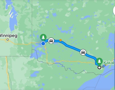
Today was one of our longer drives… almost 6 hours from not quite Thunder Bay to not quite Kenora. It was an easy, uneventful, unstressful drive. It’s a holiday in Canada today and not as many trucks. We both drove, stopping for lunch at the Tim Hortons in Dryden
We’re about 3 hours east of Winnipeg. We have been travelling now for 3 weeks and we are still in Ontario, until tomorrow when we finally pass into Manitoba. This is indeed a huge province. We’ve driven approximately 2,500 miles since we left home. Once we get into Manitoba it will start to feel like we are in central/western Canada.
We gained an hour at longitude 90 degrees and we are now on central time.
So far no smoke from the Alberta fires and up until today, no blackflies. It’s warmer here than we’ve seen since we left Timmins. It’s into the 70s and with the warmer weather and little wind, out came the bugs. I put the shelter up for the first time.
We should have warm to hot weather from here on and we switched clothing, putting away some of our cold weather apparel and got out sun hats, sandals, capris, shorts and t-shirts. I am getting into the habit of making sun ice tea in one of our water bottles as soon as we get into camp.
Not much to photograph today nor much to say about the little towns we passed through. The scenery didn’t change for several hours. Lots of trees and water. The highway follows the railroad for the most part and also telecommunications towers that go through here. We had cell network the whole way and also here in camp.
So tell me. How can we be in some of the remotest unpopulated areas of northern Ontario and still have decent to good cell network, and not in my own driveway at home? We didn’t have network like this driving through the Dakotas, across Minnesota, Wisconsin and Michigan two years ago either…. hmmmm…
We are still finding pockets of farming although not great farming especially around Dryden, ON a little east of here. It’s still mainly forestry and mining and tourism for all the water related recreation on the thousands of lakes and rivers here.
Lots of Minnesotans in our campground tonight.
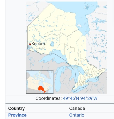
Our campground is situated on Lake of the Woods. This is an area on the Ontario map that used to fascinate me. So far north. What was it like?
The Lake of the Woods is the second largest fresh water lake in Ontario, Canada spanning over 2,414 square kilometres (1,500 square mi.).
Note: this statement puzzles me. Apparently we are not including the Great Lakes, 5 of which Ontario borders. Using that calculation then, Lake Nipigon is the largest freshwater lake in Ontario not including the great lakes. Remember Nipigon north and east of Thunder Bay?
Lake of the Woods stretches 104 kilometres (65 mi.) from its most northern point to its southern point and 88 Kilometres (55 mi) west to east. All in all… Lake of the Woods includes over 14,500+ islands and contains over 104,600 kilometres (65,000 mi.) of rocky, sandy and forested shoreline. The main communities located on its shoreline include Kenora, Sioux Narrows, Rainy River and Nestor Falls.
The largest management area protecting moose in Ontario, Canada is located on the Aulneau Peninsula which is part of the Lake of the Woods. The Aulneau Peninsula measures 32 kilometres (20 mi.) long and 16 kilometres (10 mi.) wide. Within the peninsula are 80 lakes and 13 islands.
Many of the islands within the Lake of the Woods are nesting and feeding grounds for bird populations like the piping plover, bald eagle and white pelican.
Lake of the Woods crosses borders between Canada and USA. The lake sprawls out occupying parts of Ontario and Manitoba in Canada… and parts of Minnesota in the United States. The shoreline of Lake of the Woods is home to many communities and First Nation villages of the Northwest Angle 33 First Nation, Anishinabe of Wauzhushk Onigum First Nation, Big Grassy First Nation, Northwest Angle 37 First Nation, Ojibways of Onigaming First Nation, Anishnaabeg of Naongashiing First Nation, Ochiichagwe’Babigo’Ining Ojibway Nation, Obashkaandagaang Bay First Nation and the Naotkamegwanning First Nation peoples. On the Manitoba, Canada shoreline of the Lake of the Woods is the community of Middlebro and the village of the First Nation Buffalo Point people.

I remember hearing of Lake of the Woods when I was a kid in the Midwest.Keep traveling——JB
Sent from the all new AOL app for iOS
LikeLike