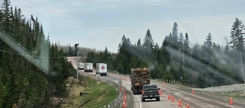
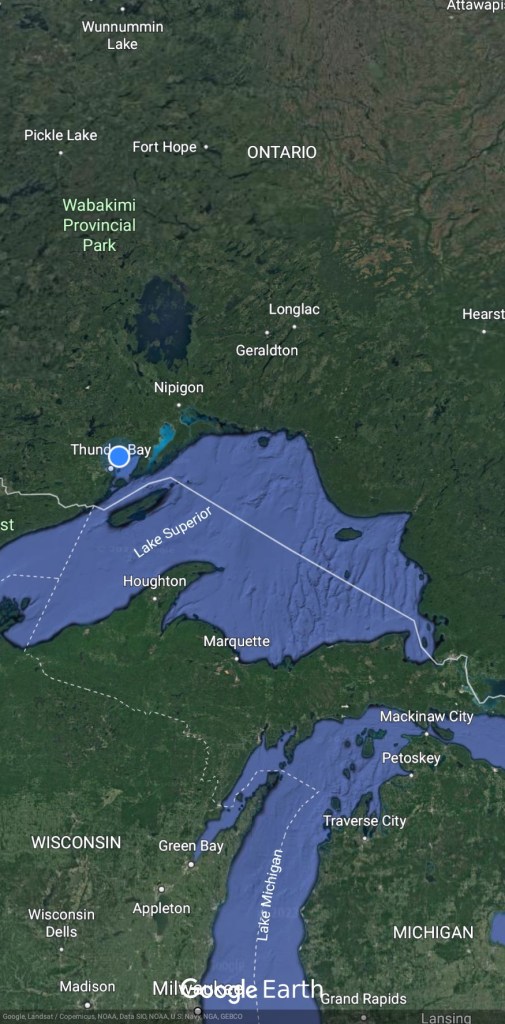
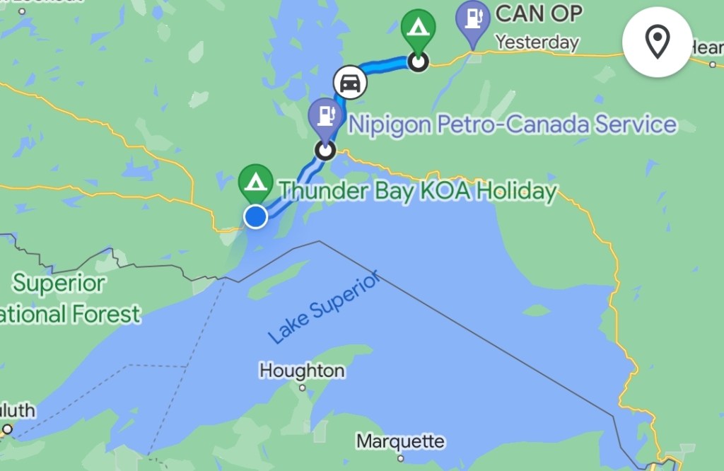
Not an exciting start to the day as it was chilly and overcast. Today’s drive takes us to the Thunder Bay KOA through Nipigon. After driving west and north yesterday from Cochrane, we take a southerly turn to Thunder Bay. We pick up highway 17 at Nipigon just before the bridge over the Nipigon River. This is the major truck route east and west. We’ve seen (and passed) a lot of logging trucks. Most of this part of the TransCanada Hwy is only 2 lanes.
The scenery is lovely with trees, rocks, lakes, rivers. Building roads through here is a challenge but there is a lot of work being done for road improvement.
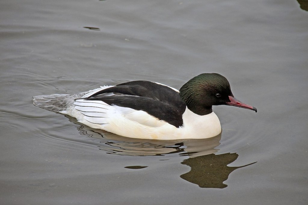
Yesterday we saw Sandhill Cranes and today it has been mainly Common Merganzers and Loons on the water and more than their fair share of crows, ravens and Canada Geese. The male merganzers stand out. They are a fairly large duck with distinctive white bodies with black patches and black heads.
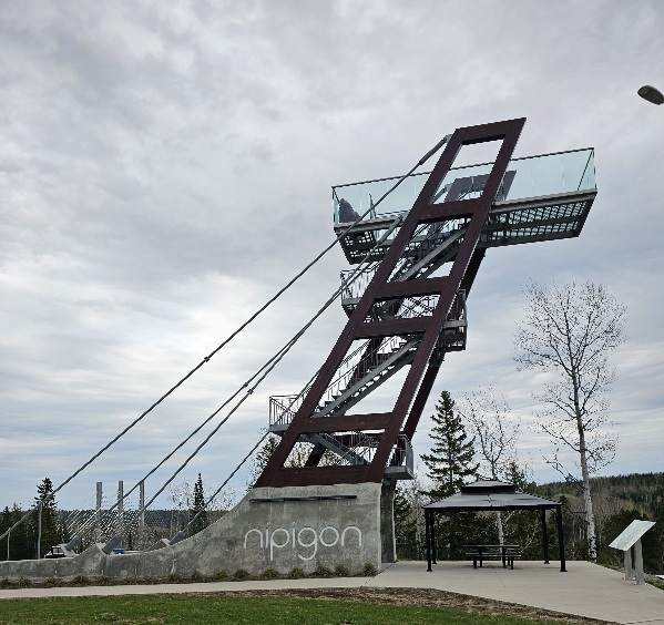
Nipigon, ON
Nipigon (/ˈnɪpɪɡən/) is a township in Thunder Bay District, Northwestern Ontario, Canada, located along the west side of the Nipigon River and south of the small Lake Helen running between Lake Nipigon and Lake Superior. Located at latitude 49.0125° N, Nipigon is the northernmost community on the Great Lakes.
The chief industries in Nipigon are forest products, fishing, and tourism.
Nipigon is a setting off point for fishing excursions onto Lake Superior and the Nipigon River system leading up to Lake Nipigon. Fish varieties common to this area include Atlantic salmon, lake trout, speckled trout (the world’s largest speckled trout was caught in the Nipigon River in 1915, weighing in at 14.5 pounds (6.6 kg), rainbow trout, walleye, northern pike, bass, and perch.
There are two bridges at the east end of town spanning the Nipigon River: one is a single-track railway bridge belonging to the Canadian Pacific Railway, and the other is a two-lane highway bridge constructed by the Province of Ontario.
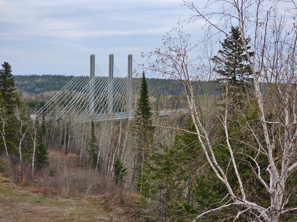
The Nipigon River Bridge, originally opened in 1937, forms the narrowest transportation bottleneck between the Atlantic and Pacific oceans in Canada. Both Highways 11 and 17 and the Canadian Pacific Railway route all their traffic across those bridges.
The Nipigon River Bridge is a pair of two-lane cable-stayed bridges, the first of their kind in Ontario, replacing the 1937 bridge. On January 10, 2016, the first bridge heaved apart but did not collapse, resulting in traffic having to reroute through the United States.
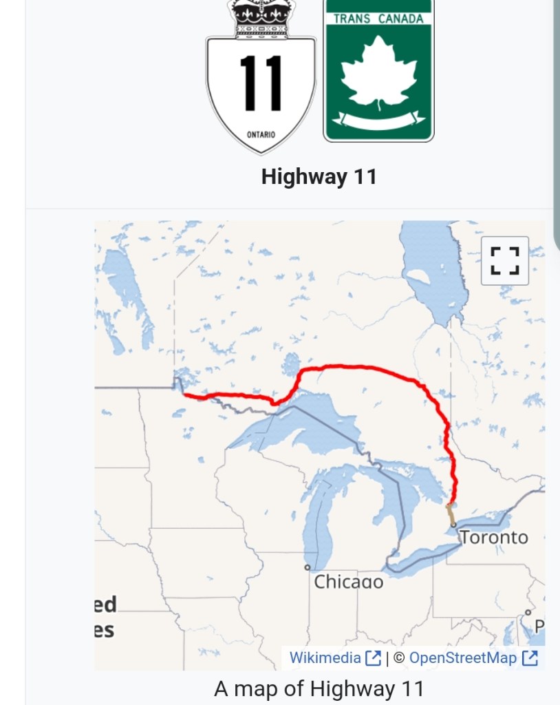
King’s Highway 11, commonly referred to as Highway 11, is a provincially maintained highway in the Canadian province of Ontario. At 1,784.9 kilometres (1,109.1 mi), it is the second longest highway in the province, following Highway 17. Highway 11 begins at Highway 400 in Barrie just north of Toronto and arches through northern Ontario to the Ontario–Minnesota border at Rainy River via Thunder Bay; the road continues as Minnesota State Highway 72 across the Baudette–Rainy River International Bridge. North and west of North Bay, Highway 11 forms part of the Trans-Canada Highway. The highway is also part of MOM’s Way between Thunder Bay and Rainy River.
Highway 11 varies between a divided four-lane urban freeway and a two-lane rural road. It travels through surroundings ranging from cities to farmland to the uninhabited wilderness. The section through northern Ontario includes several sections with no gas or service for over 160 kilometres (100 mi). We drove this section yesterday. Heeding the ‘better check your gas guage’ signs at the last gas station for 100 miles is critical.
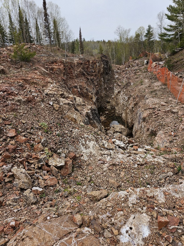
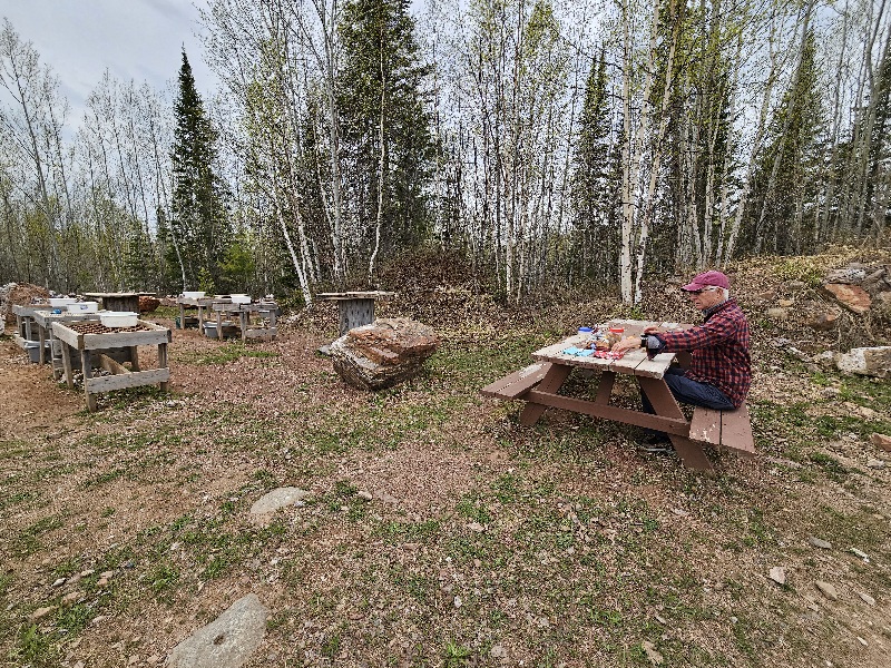
Diamond Willow Amethyst Mine, Pearl ON
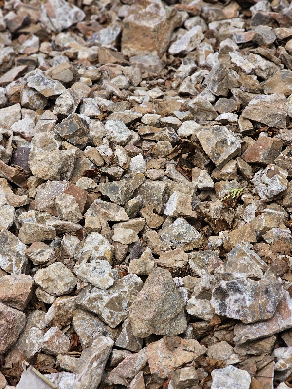
This area is noted for its amethyst mines and we found one that was open today. We had no idea what to expect including the tortuous road to get to it. Spring run off does a real number on dirt roads.
To make a long story short, it was a DYI place ie you get a bucket and a shovel and go out to the rubble along the pits and find your own rocks. Then you can wash them. You pay by the bucket full. We got about $5 worth of amethyst rocks. We can’t carry more than that.
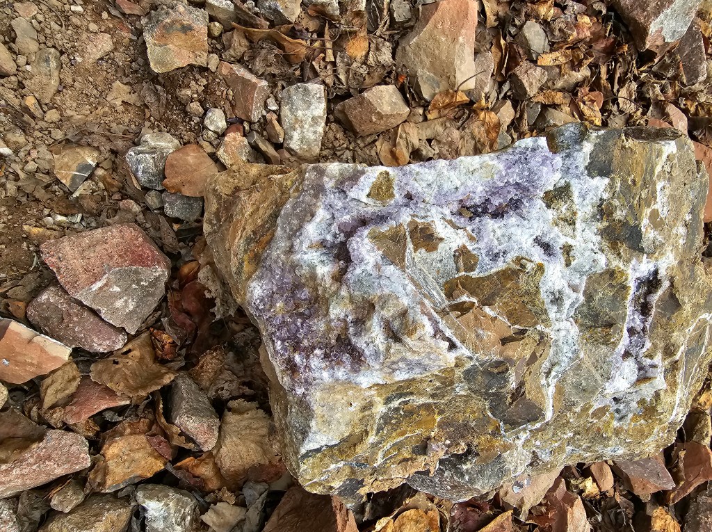
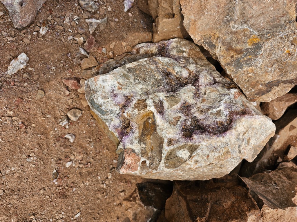
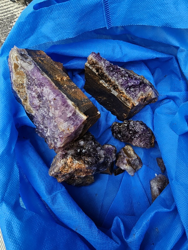
Amethyst is a violet variety of quartz. The name comes from the KoineI Greek αμέθυστος amethystos from α- a-, “not” and μεθύσκω (Ancient Greek) methysko / μεθώ metho (Modern Greek), “intoxicate”, a reference to the belief that the stone protected its owner from drunkenness. Ancient Greeks wore amethyst and carved drinking vessels from it in the belief that it would prevent intoxication.
Amethyst is relatively common in the Canadian provinces of Ontario and Nova Scotia. The largest amethyst mine in North America is located in Thunder Bay, Ontario.
Cross-culturally, this popular gemstone was used as a symbol of peace and unification. It is also thought to evoke feelings of serenity and calmness in those who wear it. Amethyst is often used during meditation to provide an overall sense of spiritual balance.
Well, we should have lots of peace and tranquility for the rest of our trip.
There is a lot of white birch now and are beginning to send out their pale green spring foliage.
Loons
I have a special fondness for these birds. Along with their beautiful plumage, they have engaging calls. There is nothing more wonderful than to hear the loons calling to each other over water. A loon communicates with four distinct calls: tremolo, wail, yodel and hoot. They are excellent divers and strong flyers but since their feet are located far back on the body, loons have difficulty walking on land, though they can effectively run short distances to reach water when frightened and they need a lot of water for take off when flying. Thus, loons avoid coming to land, except for mating and nesting.
Loons are migratory birds. Found in every province and territory in the country, the Common Loon is truly a Canadian animal. It spends the winter months along the Pacific and Atlantic coasts of North America, from Alaska and Newfoundland in the north to Mexico in the south, as well as in Europe and Iceland
The loon is the official bird of the province of Ontario (and also the state bird of Minnesota). Considered a symbol of wilderness and solitude, the common loon is known for its haunting voice. It is also featured on Canada’s one dollar coin, aptly nicknamed ‘the loonie’. A group of loons is called an ‘asylum’. Crazy as a loon, eh?
There are many native stories about how the loon got his necklace. Just Google it and find out.
We got into our campsite at the Thunder Bay KOA at around 2:30. We had planned an early arrival to do some ‘household’ chores like laundry. This is a very well run campground with good facilities including streamable quality wifi. It is supposed to rain later and we managed to do our laundry and get all of our walking done for the day. I think this is an indoor eating night.
Rain tomorrow too. We will spend as muchbif the day as we can in Thunder Bay.
It gets dark late here. Hard to believe we are in the same time zone as home. Being that much farther west and north does it. We change time zones closer to Manitoba somewhere. Not sure where. Guess we will fund out soon enough.

You must be logged in to post a comment.