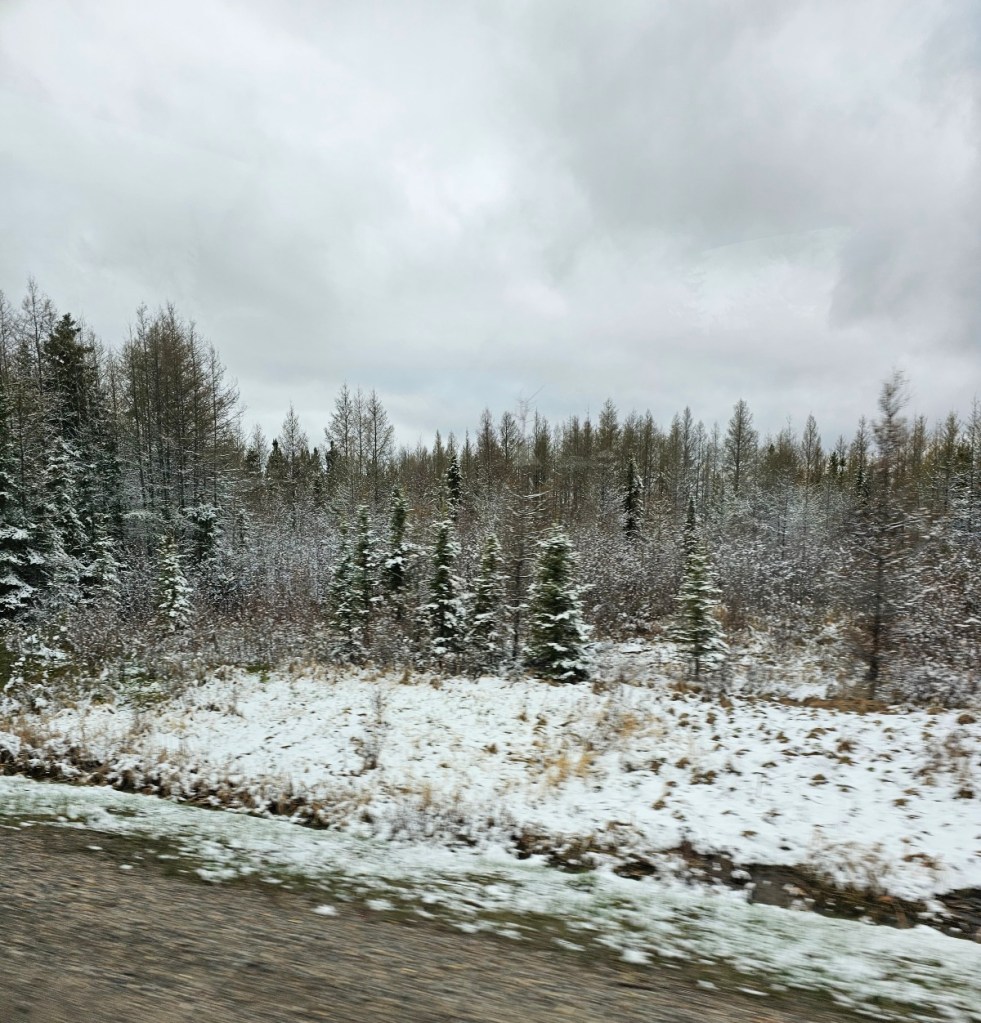
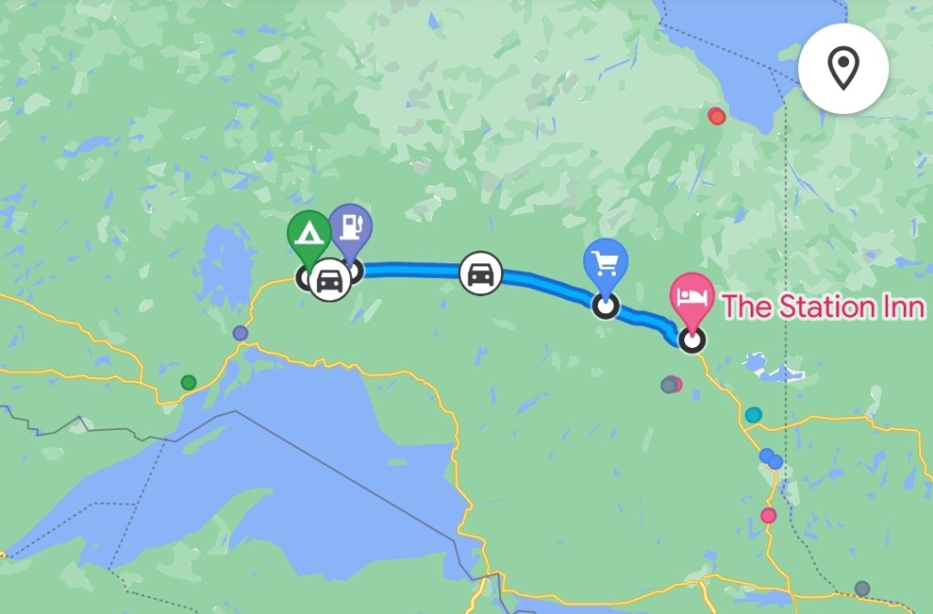
We were up early this morning. It snowed a little bit over night and temperatures were still below freezing. We had a lovely breakfast at the Cafe at the Station Inn. Everything is AOK with the van after it sat for 2 days in the ONR parking lot. It’s still overcast.

Today we start the second phase of our trip and a change of our lifestyle. We are on our own now until we meet up with Brian’s brother in either Alberta or British Columbia. We leave the nightly stays with family and the hotels behind and get back to camping. We will now be able to establish a routine. We need to buy some food!
My father-in-law worked a sales territory along this route in the 60s and talked about the towns we will be passing through. Also when I was in university, I had classmates from most of these communities. Strung out along the railroad, most of them are French speaking farmers who came from Quebec in the early 1900s to farm the ‘clay belt’. The soil in this area is black!
Ontario’s Claybelt
The Clay Belt is a vast tract of fertile soil stretching between the Cochrane District in Ontario, and Abitibi County in Quebec, covering 180,000 square kilometres (69,000 sq mi) in total with 120,000 square kilometres (46,000 sq mi) of that in Ontario. It is generally subdivided into the Great Clay Belt to the north running eastward from Kapuskasing, past Lake Abitibi and on to Amos in Quebec, and the V-shaped Lesser Clay Belt to its south, running from Englehart (which we drove through on our way north) down to the Wabi River to Lake Timiskaming. The Clay Belt is the result of the draining of the Glacial Lake Ojibway around 8,200 BP, whose lakebed sediment forms the modern landform. The Clay Belt is surrounded by the Canadian Shield, forming an island of “southern flatlands” in the midst of the hilly and rocky surroundings.
Moonbeam, ON
The name “Moonbeam” is attributed to early pioneers who allegedly witnessed flashing lights falling from the sky, which they called “moonbeams”. These lights fell down or reflected in a creek that flows west from Strickland to Rémi Lake and was called Moonbeam Creek. These lights could have been Northern Lights that often appear with the moon light.

The National Transcontinental Railway, connecting Quebec City with the Canadian Prairies, was completed by 1912 and provided new access to agricultural land and natural resources of northern Ontario. This attracted colonizers from Montreal, Sainte-Agathe-des-Monts, and Saint-Jovite, to the Moonbeam area, looking for land to cultivate or mine.
By 1935, immigration to the Great Clay Belt virtually ended. One farmer, describing why he returned to urban life, stated that, in the Great Clay Belt, “there are seven months of snow, two months rain, and all the rest is black flies and mosquitoes.” Some of the farmers returned to Toronto and Montreal. Some moved west to the prairie provinces of Manitoba, Saskatchewan and Alberta once the National Transcontinental Railway was completed. Many of the farmers shifted to mining once minerals were found in the area. Others entered the logging industry. Some towns still remaining today include Cochrane, New Liskeard, Timmins, Kapuskasing, and Hearst.
Kapuskasing, ON
The town of Kapuskasing (pronounced ka-pus-KAY-sing) gets its name from the Kapuskasing River, which was named long before the existence of the town. Kapuskasing is a word of Cree origin meaning “bend in the river”
In 1900, the Bureau of Colonization of the Ontario Department of Agriculture sent parties to survey the region north of the Canadian Pacific Railway between the Quebec border and Lake Nipigon. Their main interest was to seek out and delimit areas for further agricultural settlements that would give Ontario a new farming frontier to offset the attraction of the western prairies.
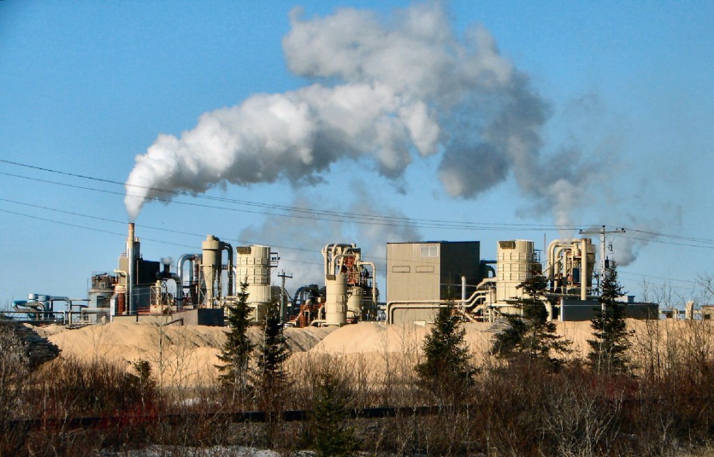
The New York Times: The Kapuskasing River Pulp and Timber limit included 4,500 square kilometres (1,700 sq mi) of timber and hydro leases at Sturgeon Falls, White Spruce Rapids (Spruce Falls) and Big Beaver Falls. The still unexploited timber limits were sold to Kimberly-Clark in 1920. The new Spruce Falls Company Ltd. began the development of the first pulp mill in Kapuskasing. In 1926, the Spruce Falls Power and Paper Company was incorporated under joint ownership of Kimberly-Clark and The New York Times. Since July 13, 1928, The New York Times has been printed entirely on Spruce Falls paper. The mill has run continuously ever since. The company became known locally as “Uncle Spruce” in affectionate reference to the steady work and benefits provided to this distinct northern community for many decades.
Internment Camp: During World War I, the town was the site of one of the largest internment camps in Canada, at Bunk Houses in Kapuskasing from December 1914 to February 1920.The camp held over 1,300 German, Austrian, and Turkish prisoners, though originally the majority were civilian internees of Ukrainian descent who had emigrated from the provinces of Bukovina and Galicia, their homeland, which at the time were part of the Austro-Hungarian Empire, in the first wave of Ukrainian emigration to Canada prior to 1914. Prisoners were employed in the construction of buildings and clearing of land for a government experimental farm on the west side of the Kapuskasing River. Isolation provided ideal security for the minimum security camp, as the railway was the only access to the remote location. Prisoners who attempted to escape into the bush were turned back by endless muskeg and clouds of mosquitoes or minus-40 degree temperatures in winter. In 1917, most were paroled to help relieve labour shortages. Afterwards, the camp was used for prisoners of war and political radicals until its closure in 1920.
Radar site: During World War II, Kapuskasing was one of five Northern Ontario radar bases that were set up to watch for potential attacks on the Soo Locks in Sault Ste. Marie, Michigan. Kapuskasing was the headquarters for the radar bases, which were manned by the United States Army Air Forces and now has become a site for the Super Dual Auroral Radar Network that is involved with tracking and measuring ionospheric turbulence.
Hearst, ON


The town was established as a divisional point of the National Transcontinental Railway in 1913, 208 km west of Cochrane. Just over 96% of the town’s residents speak French as their mother language, the highest proportion in Ontario. The town is home to the Université de Hearst, formerly a federated school of Laurentian University in Sudbury.
Hearst has a long tradition of being a “lumber town”. Currently the major employers include a Tembec hardwood and softwood facility as well as a plywood.
Sandhill Cranes
We’ve seen Sandhill Cranes feeding along the side if the road west of Hearst.
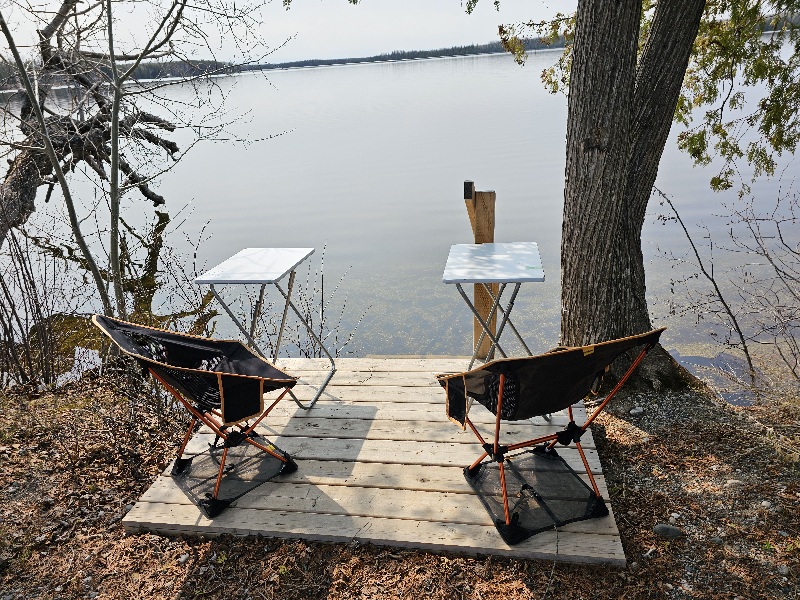

Spring has just barely started to make an appearance here. There are still pockets of snow in places. It was chilly last night but we did manage to BBQ a steak and eat outside until I got too cold. That steak was welcome after 3 days of train and microwavable food.
Cell network in this area has been surprisingly good with only pockets in the most remotest of areas (and of course campgrounds) where it hasn’t been available. Canadians pay the highest fees in the world for network service but at least they have it! We live 45 miles from NYC and 30 miles from Philadelphia. I lose network when I’m in my own driveway! Come on T-Mobile, get with it!!
It was good to be back camping again. We do enjoy the lifestyle and having everything in one place is convenient. We can actually set up in camp faster than we can move in and out of a motel. Hiking boots and winter jackets have been stowed away for now.

You must be logged in to post a comment.