We left camp early today as we have revised our travel plans somewhat. We had originally planned to try to get a campsite in the North Unit of TRNP but decided just to drive the loop and then head cross country to see the Knife River Indian Village and find something closer to Bismark. After today we have 3 days of deadheading east to Wisconson. This change shortens tomorrow’s drive somewhat and we can take some secondary roads today.
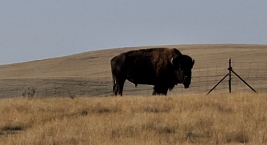
We stopped at the Painted Canyon Visitor Center for a view. We were greeted by a herd of Bison grazing near the picnic shelters right at the entrance.
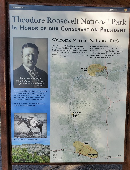
In Honor of a President
When Theodore Roosevelt came to Dakota Territory to hunt bison in 1883, he was a skinny, young, spectacled dude from New York. He could not have imagined how his adventure in this remote and unfamiliar place would forever alter the course of the nation. The rugged landscape and strenuous life that TR experienced here would help shape a conservation policy that we still benefit from today.
The park is comprised of three separate areas of land. The North and South Units feature scenic drives, wildlife viewing, hiking, visitor centers, ranger-led programs and much more. The undeveloped Elkhorn Ranch Unit preserves the site of Roosevelt’s “home ranch” in a remote area along the Little Missouri River
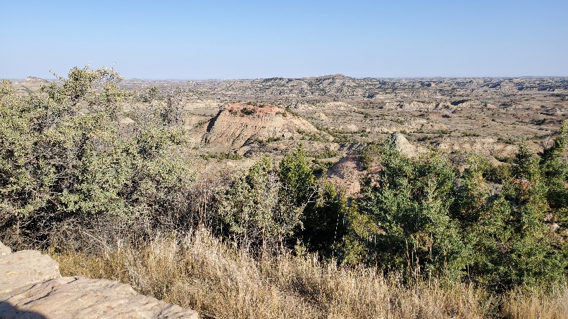
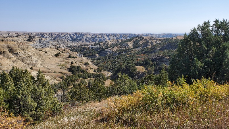
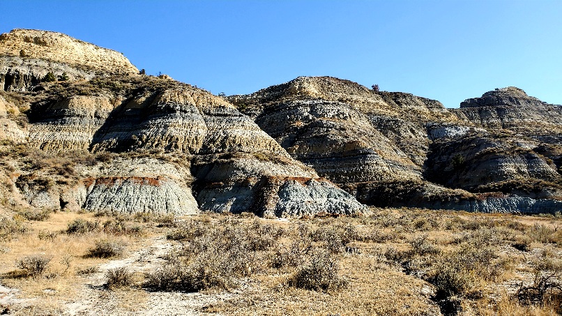
Heading up highway 85 towards the north unit, the fields are full of oil rigs and wheat. Not dissimilar to southern Alberta topographically and resource-wise.
ND apparently is the second largest oil producer after Texas. You can see the rigs from the view points in the park. The juxtaposition makes you appreciate Roosevelt’s foresight to protect our fragile areas.
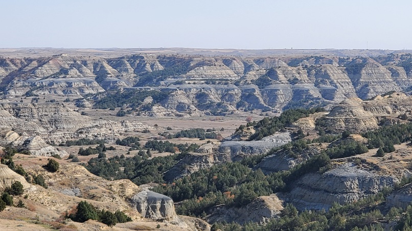
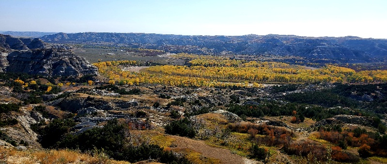
Theodore Roosevelt NP North Unit
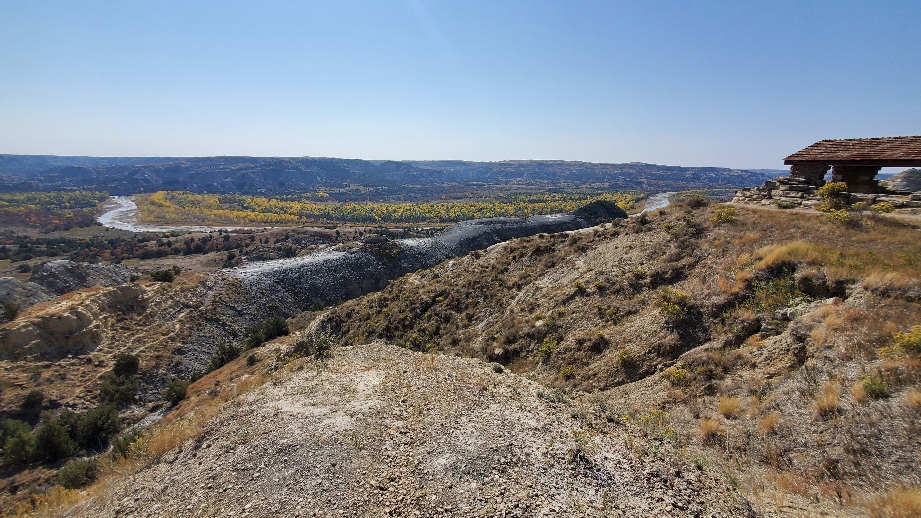
The smaller North Unit is situated about 80 mi (130 km) north of the South Unit, and Roosevelt’s Elkhorn Ranch is located between the North and South units. The Little Missouri River flows through all three units of the park. The Maah Daah Hey Trail connects all three units.
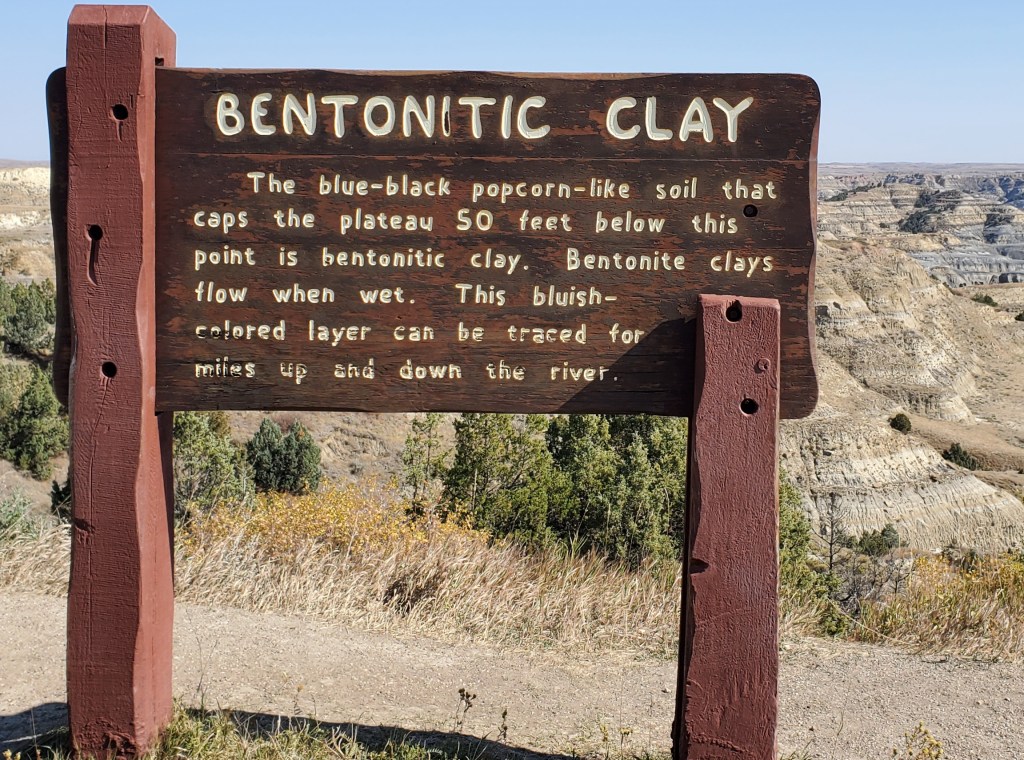
We have hiked through bentonite layers in Alberta, Canada after a rain. It swells and become gelatinous… very slippery. Bentonite clays have pharmaceutical and cosmetic usage due to their absorptive properties.
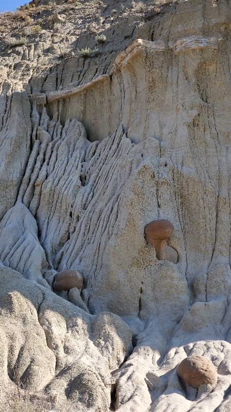
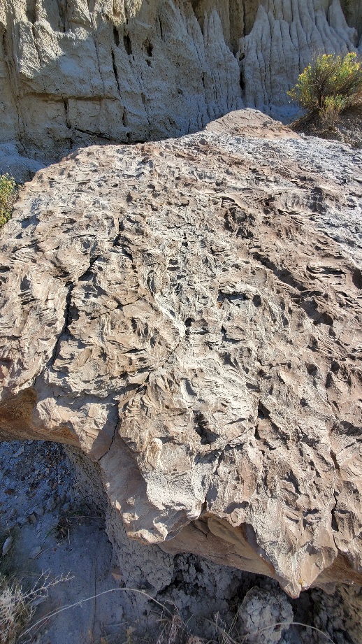
Cannonball Concretions
What are cannonball concretions? Jutting out from the landscape, these large, round stones don’t appear to properly fit into the badlands. The secret lies in the large butte located nearby.
When mineral rich water seeps down through the porous layers that make up the badlands, it can deposit those minerals in spaces or gaps in the sediments. The minerals act as a kind of glue, holding these sediments together, often forming around a core. As more and more layers are deposited, the concretion builds outward like a pearl, before being exposed by erosion.
Who knows how many concretions are still waiting to be exposed, deep inside the butte
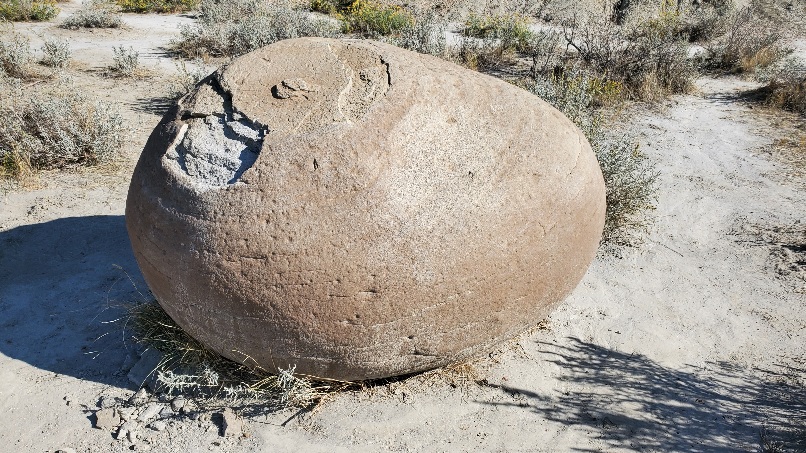
I have notice large round pock marks in the layer formations elsewhere and was curious about what they contained. Could they have been something like these cannonballs. I particularly noticed them in the rock walls at Pictograph Cave State Park in Montana.
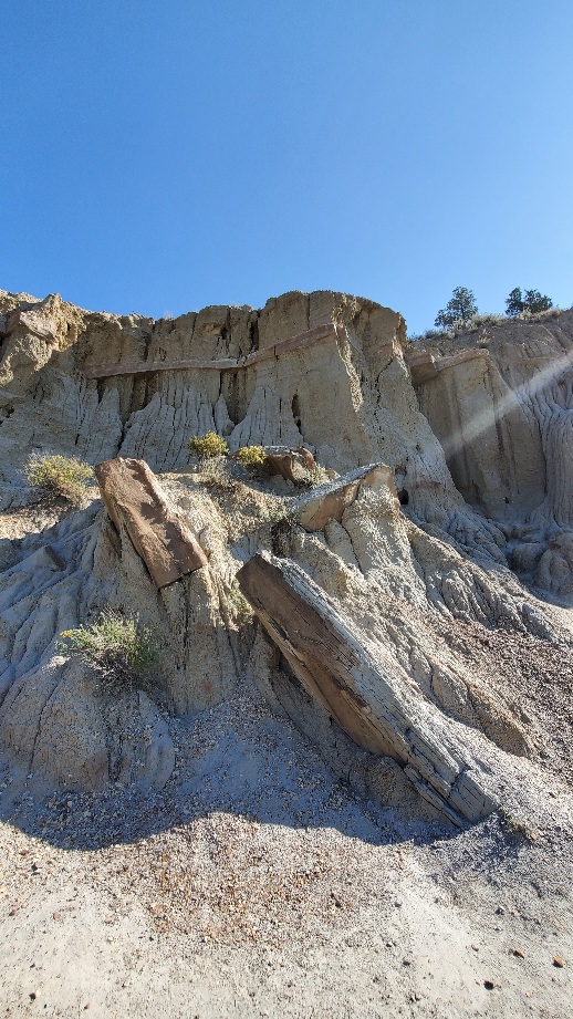
Eroding layers
Animals seen today? Several herds of Bison, a hawk and some small birds.
We have changed time zones three times, from mountain to central on entering the park (who decides time zones and why split off a corner of a state?), central to mountain leaving the park and mountain to central at some point as we headed east.
I should stop looking at the thermometer.. it’s 100F and very windy. With these open plains it’s pushing the vehicle sideways.
We arrived in Stanton,ND and the Knife River Indian Village (a national historic site) 15 minutes before closing. We lost an hour with the time zone change. It’s hot and the drive has been difficult with the wind so we did a quick inside / outside tour. Perhaps we can get back in the morning.

The Washington Post: Wild Card | It’s nearly October, and the temperature hit 100 degrees in North Dakota
https://www.washingtonpost.com/weather/2021/09/29/north-dakota-100-degrees-record/
Stanton, ND is just a few miles from Hazen mentioned in this article..
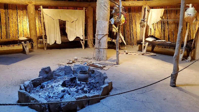
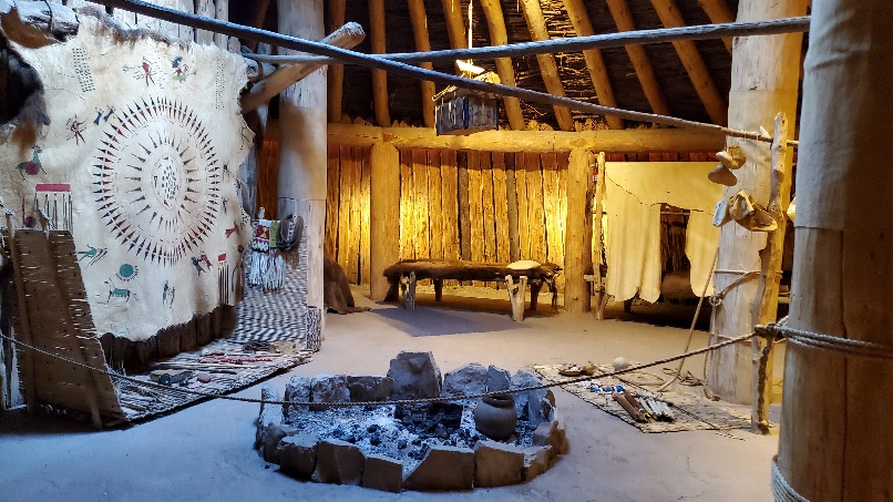
Knife River Indian Village. STANTON, ND
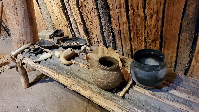
The Knife River Indian Villages National Historic Site, which was established in 1974, preserves the historic and archaeological remnants of bands of Hidatsa, Northern Plains Indians, in North Dakota. This area was a major trading and agricultural area. Three villages were known to occupy the Knife area. In general, these three villages are known as Hidatsa villages. Broken down, the individual villages are Awatixa Xi’e (lower Hidatsa village), Awatixa and Big Hidatsa village. Awatixa Xi’e is believed to be the oldest village of the three. The Big Hidatsa village was established around 1600.
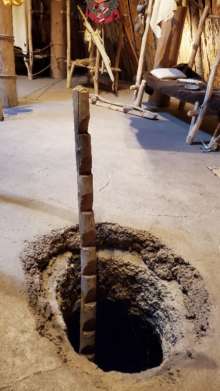
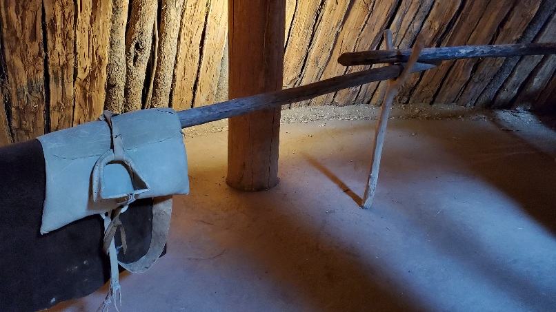
At the Knife River Indian Villages National Historical Site, there are the visible remains of earth-lodge dwellings, cache pits, and travois trails. The remains of the earth-lodge dwellings can be seen as large circular depressions in the ground. These dwellings were as large as 40 feet (12 m) in diameter. Many were once large enough to house up to 20 families, a few horses, and dogs. The dwellings were constructed at ground level. As the dwellings were abandoned, the walls and roof collapsed and created the visible outer circular rim.
Sakakawea (Sacagawea) lived in one of the villages of the Knife River. The presence of Sakakawea and her son on the Lewis and Clark expedition was extremely crucial to the safety of the party and the success of their mission. In addition to her ability to translate for them, tribes who encountered the party believed that the presence of the young woman and child indicated they were not a threat. This is due to the fact that war parties did not allow women and children to accompany them.
The Knife River Villages served as an important major central trading and agricultural area. The Native Americans served as middlemen in a trading area that stretched from Minnesota, to the Great Plains and Gulf Coast, and the Northwest Pacific Coast. Their trading business largely consisted of furs, guns, and metals such as copper, but the Hidatsa and Mandan traded corn and other agricultural products.
Smallpox epidemic
The Knife River villages thrived until 1837 when a series of smallpox outbreaks nearly wiped out the population; they suffered a 50% loss in population. Gradually survivors of the Mandan, Hidatsa, and Arikara villages migrated north and developed the village of Like-a-Fishhook.
The smallpox outbreaks from 1837–1840 had a 90% death rate among the Mandan. The two Mandan villages that had been in contact with Lewis and Clark suffered the horrific effects of the virus. The smallpox outbreak lasted from 1837–1838 and, out of 1,600 Mandan villagers, 31 survived. The smallpox epidemic was largely spread through the trading business. Despite warnings of outbreaks, Native Americans still visited trading posts and became exposed to the virus. Once the infected Mandan villages were empty, neighboring peoples raided the village for goods but suffered after carrying back the virus via blankets, horses, and household tools.
Src: Wikipedia
Visitor Center Video: Maxidiwiac https://youtu.be/gCigWsBhKWg
This is the film shown in the Visitor Center theater at Knife River Indian Villages National Historic Site. This moving account describes the life of the Mandan and Hidatsa tribes, as told by Buffalo-Bird Woman, one of the last Hidatsas born in the Knife River villages. Her story was recorded in the anthropological notes of Gilbert Wilson while he lived with the Hidatsa, Mandan, and Arikara in the early 1900s.
Our campsite tonight is Sakakawea Park campground in Stanton, ND. It was a real find, situated on the Knife River. It is a municipal campsite in a pretty little park. Other than the white tail deer and the camp host (who also happens to be the NP ranger at the Indian village) we have the place to ourselves. Beethoven with dinner tonight. With both electrical and water hookup the site is $15 / night!
The weather app reported that we are in a Red Flag warning area… which means Fire warning coupled with the extremely low humidity and the high winds. We get flood warnings at home. How different are perspectives depending on where you live.

You must be logged in to post a comment.